
// Herd Sight — Wildlife Census Survey
Count Every Animal
From Above
Precision thermal aerial surveys for wildlife population mapping and habitat assessment. Accurate, non-invasive, and scalable — from 50 to 500+ acres in a single mission.
Sensor
640×512 Thermal
Coverage
Any Property Size
Detection
Hidden in Brush & Foliage
Deliverable
Private Customer Portal With Interactive Maps, Advanced Analytics, Photos Of All Wildlife, and Much More
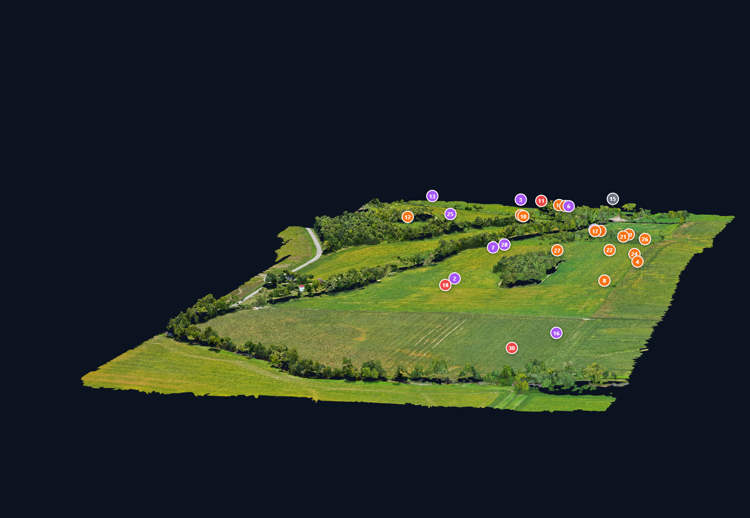
3D Photogrammetry Survey — Thermal Detection Points
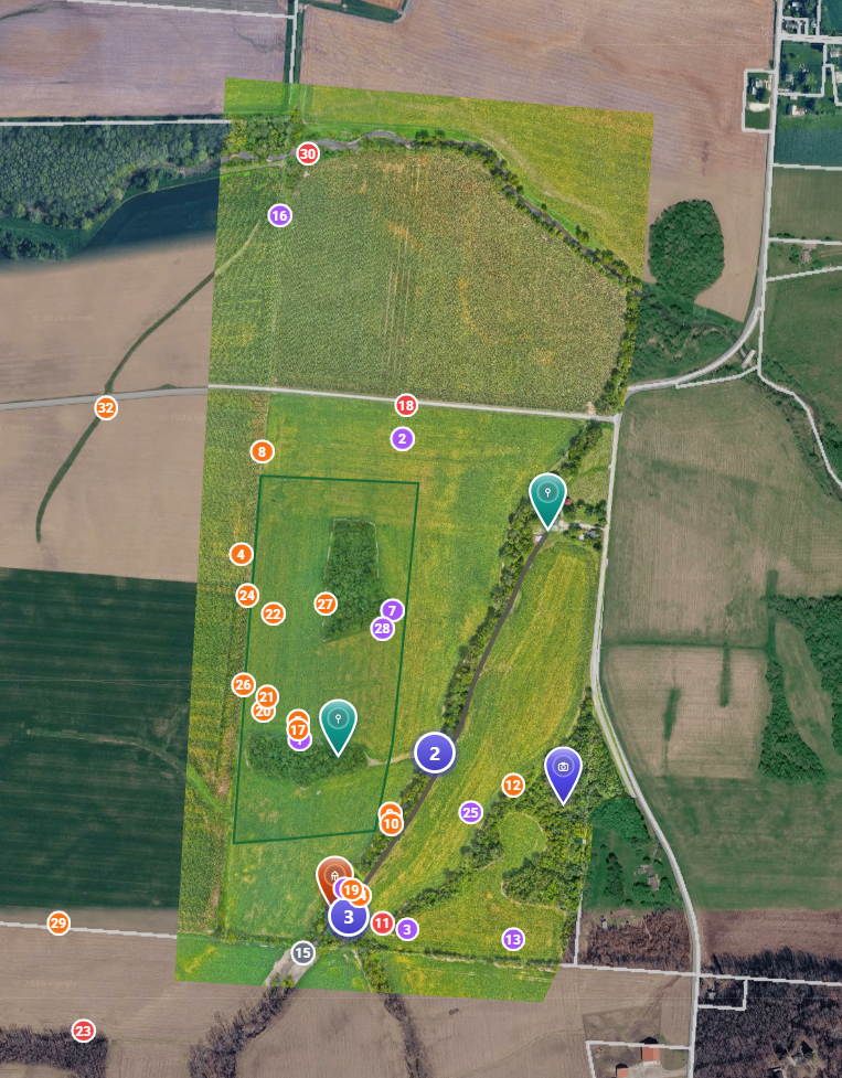
Interactive Portal Map — GPS-Tagged Wildlife Data
// Service Benefits
Accurate population counts across hundreds of acres in a single flight
Thermal detection finds animals hidden in tall grass and dense brush
Non-invasive — no disturbance to wildlife or habitat
GPS-tagged heat signature mapping for precise location data
Ideal for hunting land management and harvest planning
Conservation assessments for landowners and wildlife agencies
Delivered count report with annotated map and species breakdown
// Survey Capabilities
Deer Population Count
Precise headcount of whitetail and other deer species across open fields and wooded tracts
Herd Distribution Mapping
GPS-tagged location data showing where animals congregate and travel
Nocturnal Activity Detection
Dawn and dusk flights capture peak wildlife movement with maximum thermal contrast
Habitat Assessment
Identify bedding areas, feeding zones, and travel corridors from aerial data
Multi-Species Surveys
Turkey, coyote, feral hog, and other species identification alongside deer
Trend Reporting
Repeat surveys over time to track population changes and land management effectiveness
// Survey Process
// Ideal For
Hunting Land Owners
Pre-season population assessments for trophy and harvest planning
Wildlife Managers
Data-driven insights for habitat improvement and species management
Conservation Groups
Baseline surveys and trend monitoring for protected species programs
// Ready to Survey Your Land?
Get an Accurate Wildlife Count
From small private parcels to large-scale conservation tracts, we'll deliver professional thermal survey data you can trust for land management decisions.
Request a Survey